0
Skip to Content
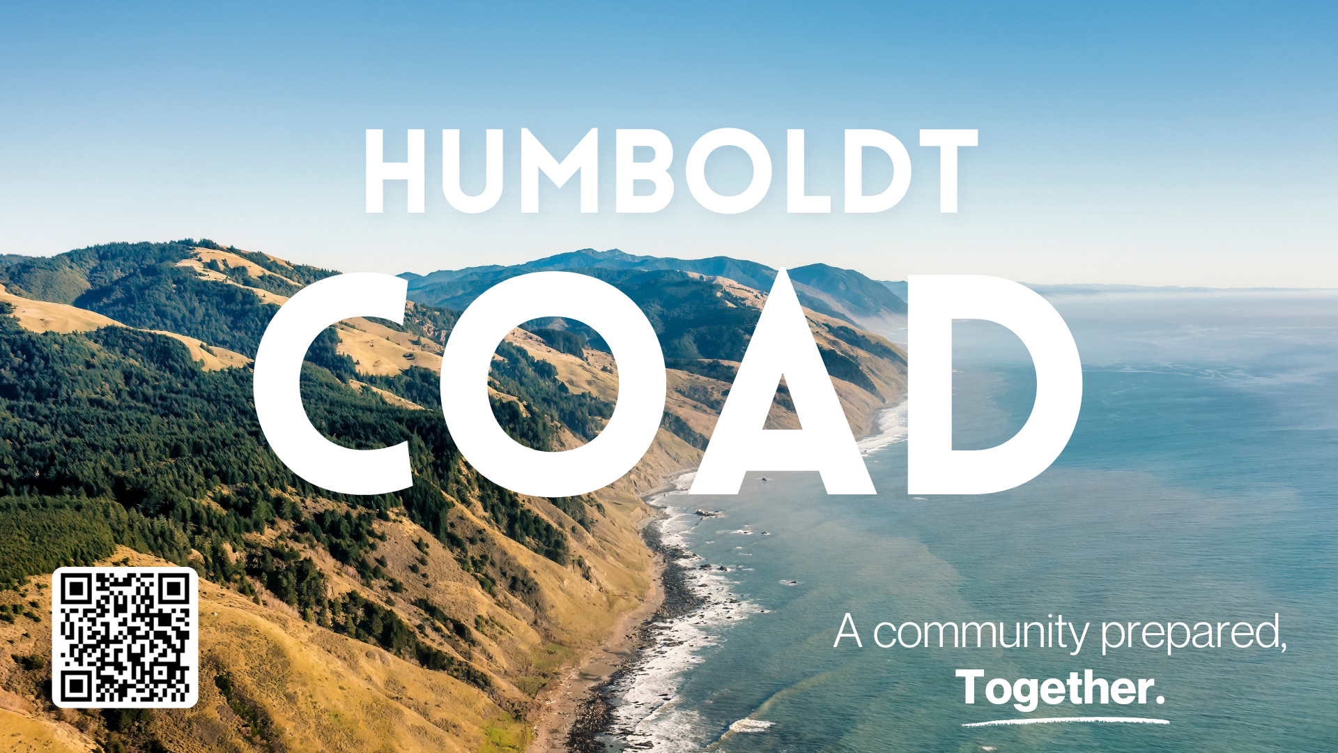
HUMBOLDT COAD
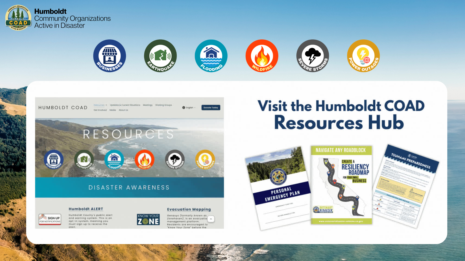
Resources
Resources
Flood Resources
Earthquake Resources
Business Resources
Updates & Current Situations
Meetings
Working Groups
Get Involved
Calendar
Media
About Us
English
Donate Today
Open Menu
Close Menu
Open Menu
Close Menu
HUMBOLDT COAD
Resources
Resources
Flood Resources
Earthquake Resources
Business Resources
Updates & Current Situations
Meetings
Working Groups
Get Involved
Calendar
Media
About Us
English
Donate Today
Folder:
Resources
Back
Resources
Flood Resources
Earthquake Resources
Business Resources
Updates & Current Situations
Meetings
Working Groups
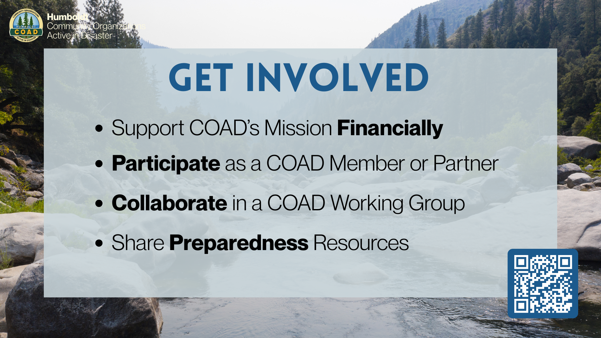
Get Involved
Calendar
Media
About Us
English
Back
Donate Today
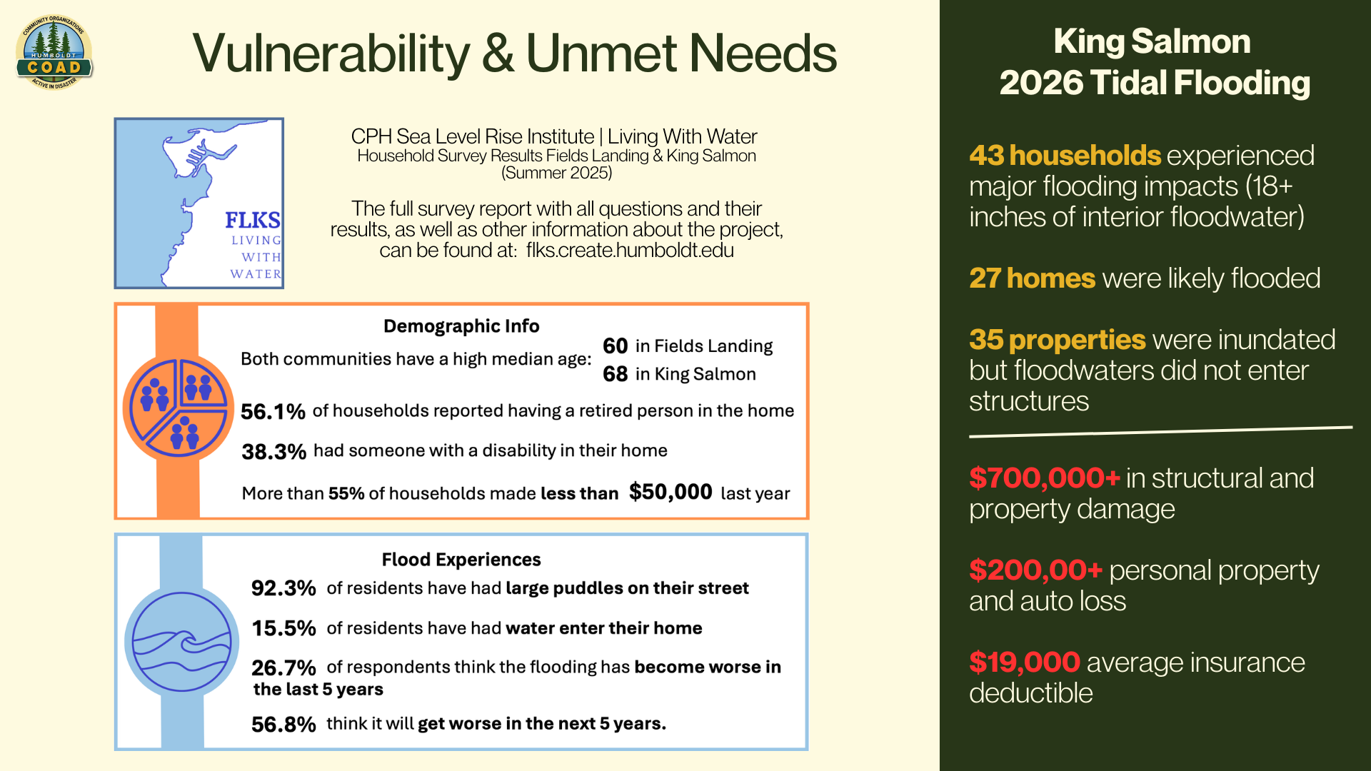
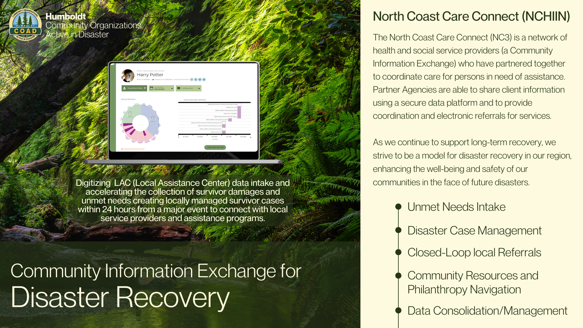
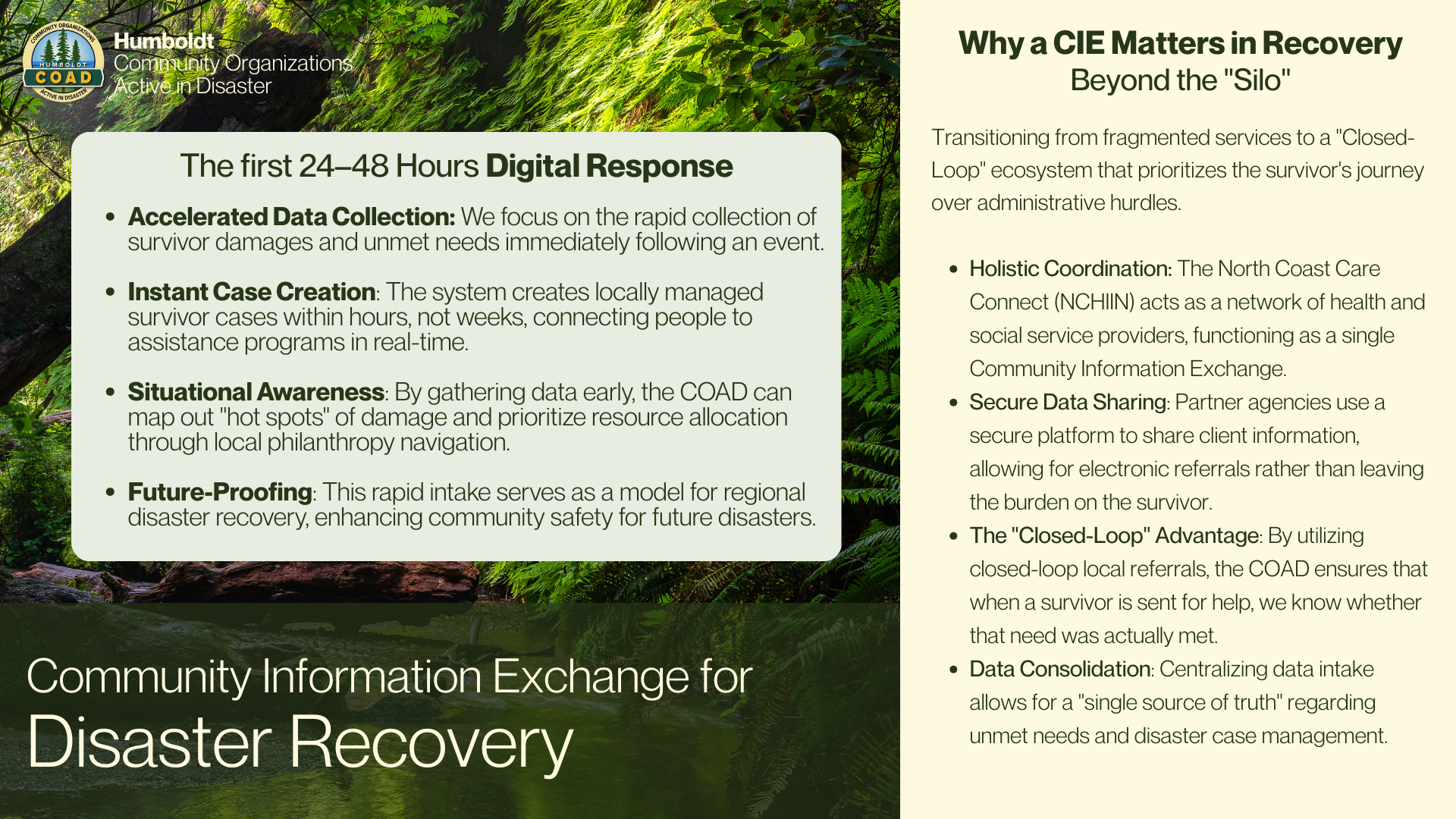
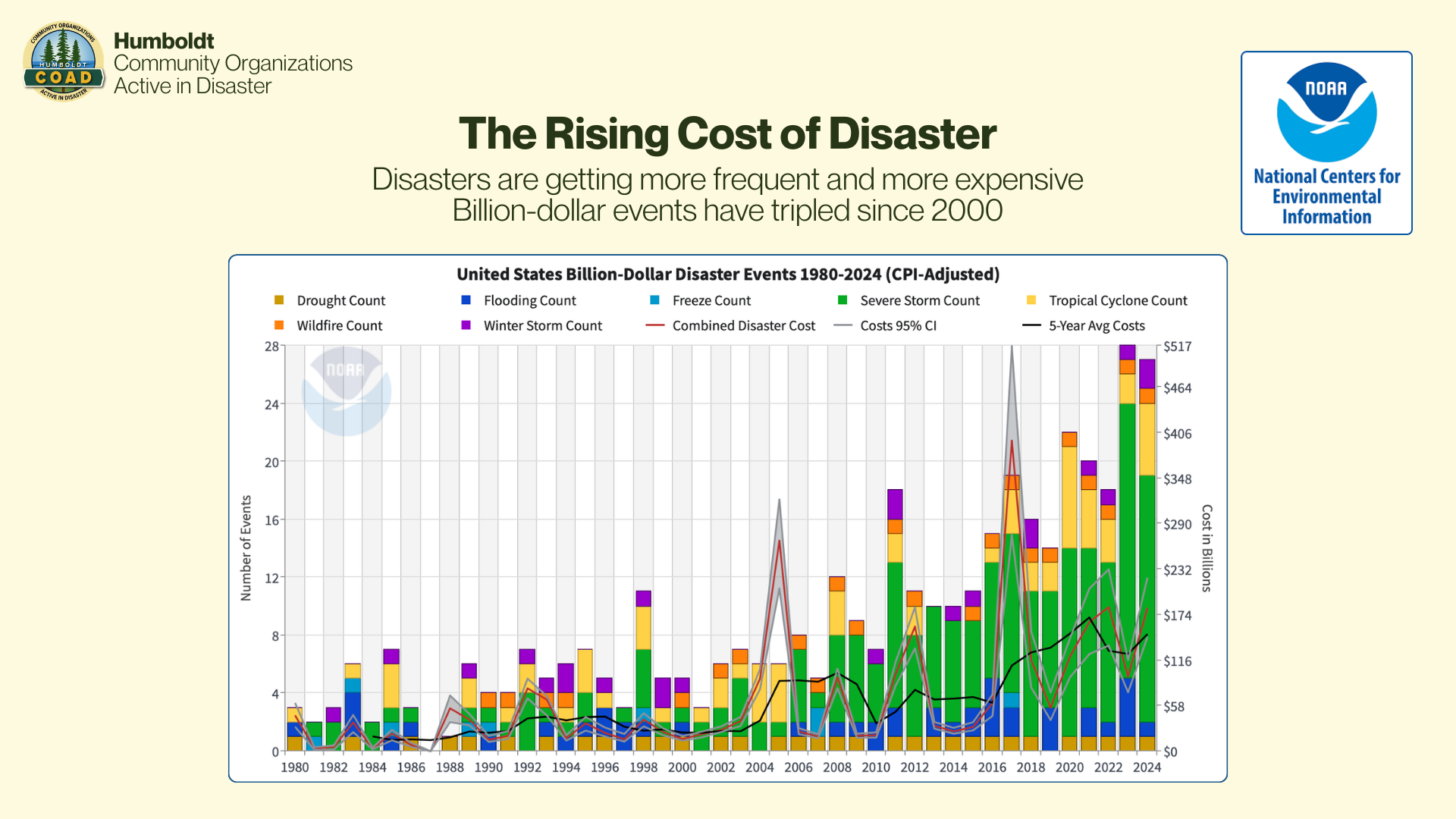
Direct Download Presentation File
Direct Download Presentation File